

Tell your friends about this item:
Delorme Atlas & Gazetteer
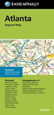
Rand McNally
 Christmas presents can be returned until 31 January

Our customers say:

Delorme Atlas & Gazetteer
Rand McNally
With an incredible wealth of detail, DeLorme's Atlas & Gazetteer is the perfect companion for exploring the Wisconsin outdoors.
Extensively indexed, full-color topographic maps provide information on everything from cities and towns to historic sites, scenic drives, trailheads, boat ramps and even prime fishing spots.
Conveniently bound in book form, the Atlas & Gazetteer is your most comprehensive guide to Wisconsin's backcountry.
Full-color topographic maps provide information on everything from cities and towns to historic sites, scenic drives, recreation areas, trailheads, boat ramps and prime fishing spots.
Extensively indexed.
Handy latitude/longitude overlay grid for each map allows you to navigate with GPS.
Inset maps provided for major cities as well as all state lands.
Product Details: Wisconsin State
Dimensions: 15.5" x 11".
AVAILABLE FOR ALL 50 STATES!
| Media | Books Hardcover Book (Book with hard spine and cover) |
| Released | November 1, 2017 |
| ISBN13 | 9781946494054 |
| Publishers | Delorme Mapping Company |
| Pages | 96 |
| Dimensions | 272 × 386 × 20 mm · 498 g |
| Language | English |
More by Rand McNally


![Cover for Rand McNally · A Pocket Atlas of the [world] [cartographic Material]: Presented to the Patrons and Friends of the Chicago & North-Western Ry. Co. With the Compliments of the Passenger Department (Paperback Book) (2021)](https://imusic.b-cdn.net/images/item/original/417/9781015179417.jpg?rand-mcnally-2021-a-pocket-atlas-of-the-world-cartographic-material-presented-to-the-patrons-and-friends-of-the-chicago-north-western-ry-co-with-the-compliments-of-the-passenger-department-paperback-book&class=scaled&v=1649334010)


Others have also bought
![Cover for Preben Hansen · Turen Går Til: Turen går til Californien & Vestlige USA (Sewn Spine Book) [5th edition] (2021)](https://imusic.b-cdn.net/images/item/original/578/9788740063578.jpg?preben-hansen-2021-turen-gaar-til-turen-gaar-til-californien-vestlige-usa-sewn-spine-book&class=scaled&v=1623395637)
![Cover for Ole Lund Kirkegaard · Læs selv: Læs selv Frode - og alle de andre rødder (Bound Book) [4th edition] [Indbundet] (2010)](https://imusic.b-cdn.net/images/item/original/121/9788702094121.jpg?ole-lund-kirkegaard-2010-laes-selv-laes-selv-frode-og-alle-de-andre-roedder-bound-book&class=scaled&v=1331420409)
![Cover for Yahya Hassan · Yahya Hassan 2 (Sewn Spine Book) [1st edition] (2019)](https://imusic.b-cdn.net/images/item/original/866/9788702265866.jpg?yahya-hassan-2019-yahya-hassan-2-sewn-spine-book&class=scaled&v=1573199860)
![Cover for Peter Ingemann · Den Gyldne Hest (Bound Book) [1st edition] (2021)](https://imusic.b-cdn.net/images/item/original/526/9788702330526.jpg?peter-ingemann-2021-den-gyldne-hest-bound-book&class=scaled&v=1633520816)


More from this series
See all of Rand McNally ( e.g. Paperback Book , Map , Hardcover Book , Book and Spiral Book )